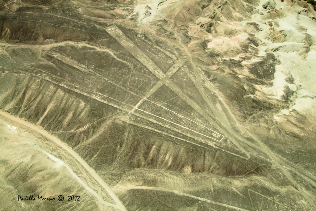
Desert Geoglyphs on an Epic Scale
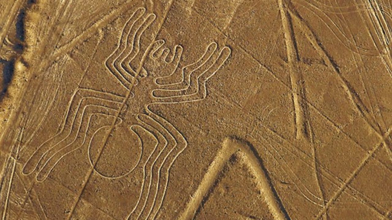
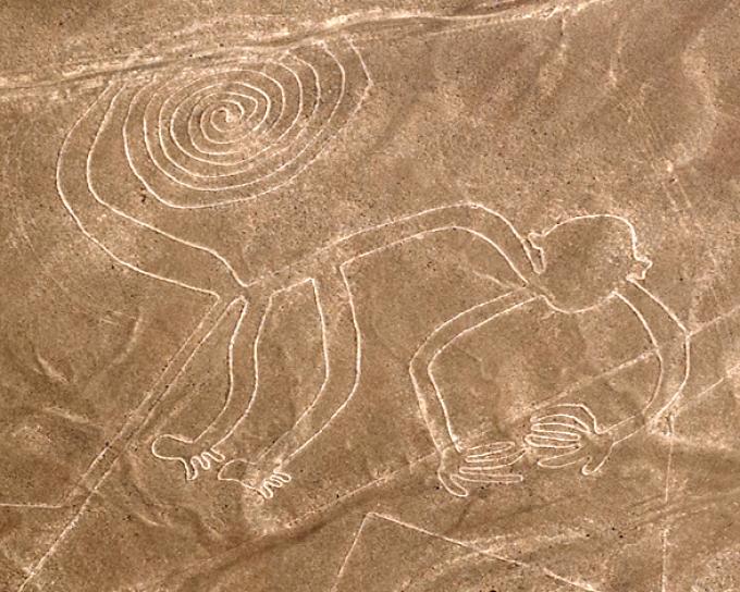
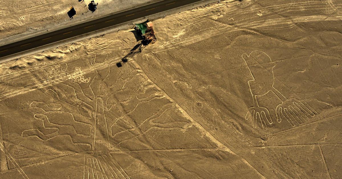
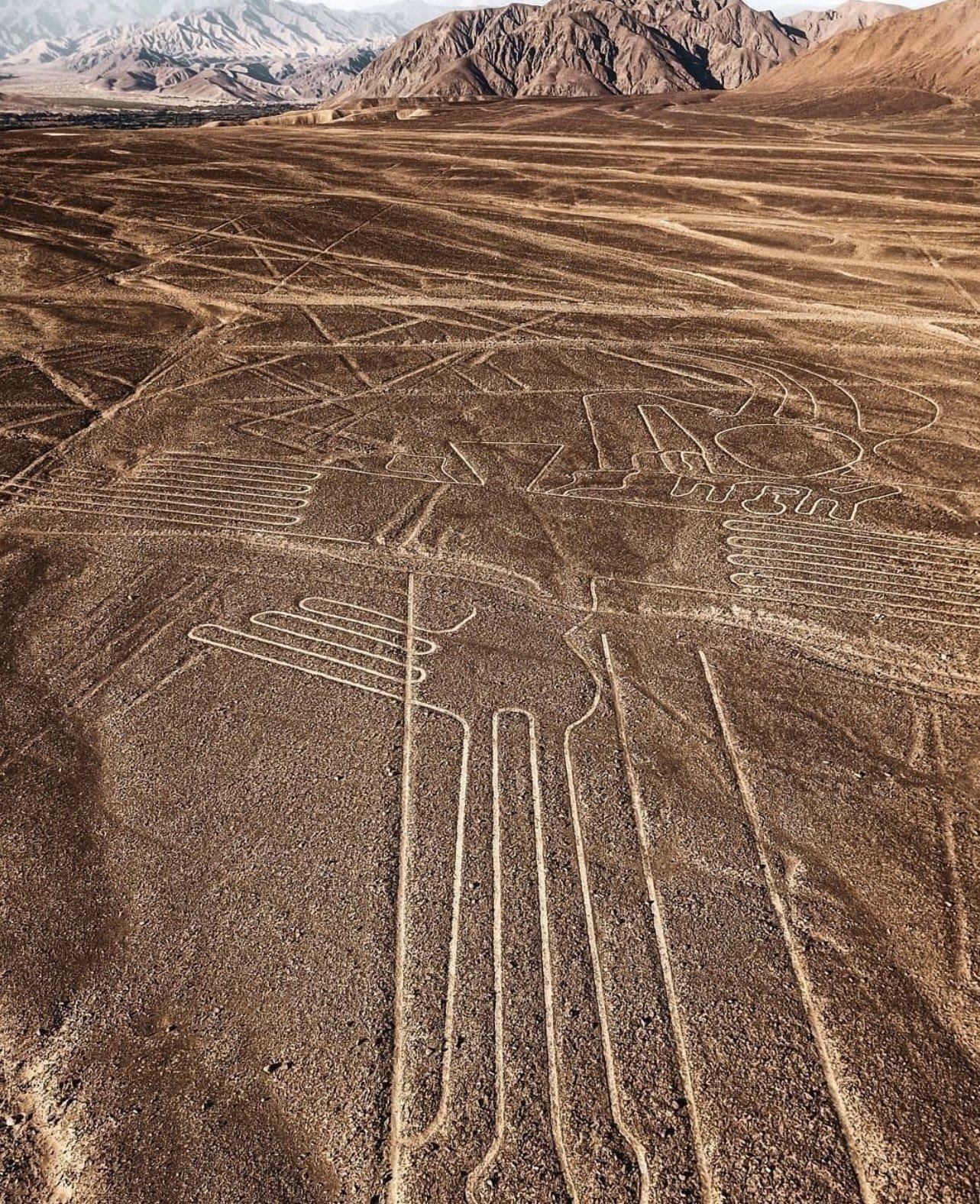
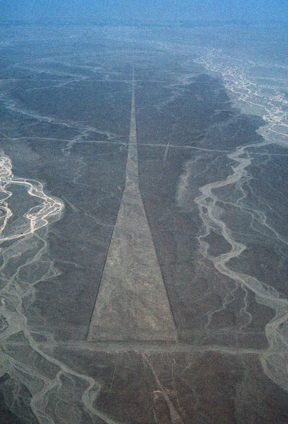
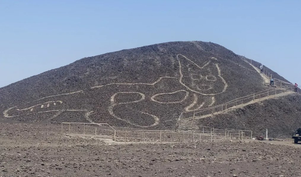
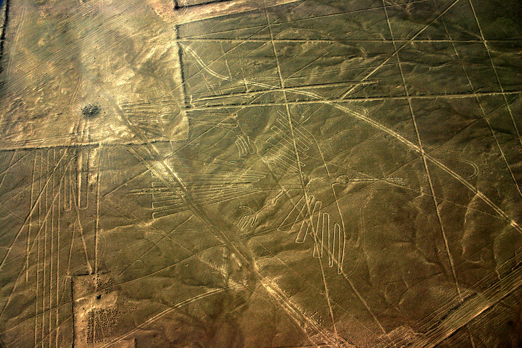
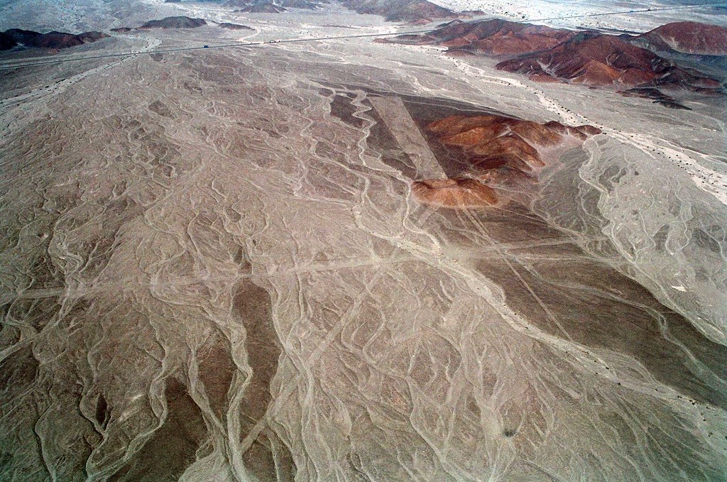
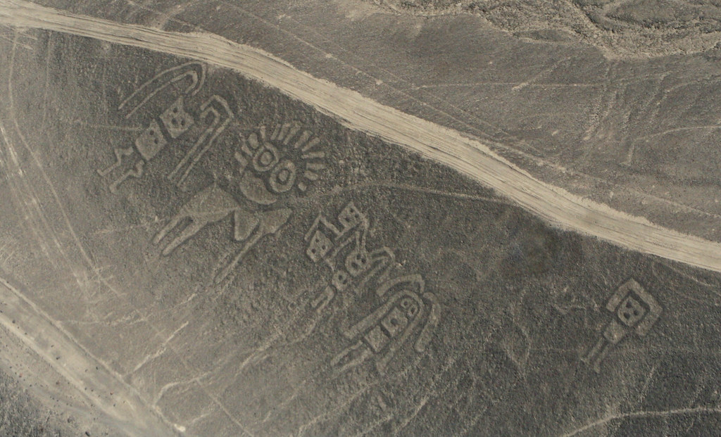
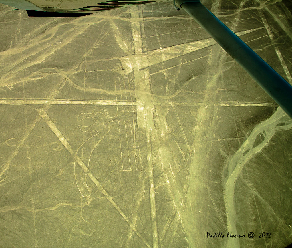
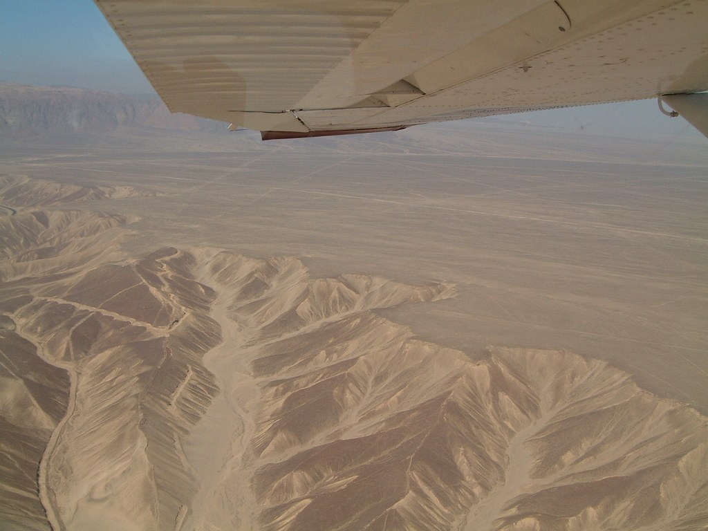
South of Lima, on the pampas between Nazca and Palpa, ancient peoples etched an immense graphic language into iron-oxide pebbles, raking aside the darker stones to expose pale soil below. The result is a high-contrast canvas that has survived for millennia thanks to aridity and low wind. Created primarily by the Nazca culture between about 500 BCE and 500 CE, with earlier Paracas contributions, the geoglyphs include biomorphs (hummingbird, spider, whale, monkey), geometric forms (spirals, triangles, trapezoids) and long perfectly straight lines that run for kilometers across desert plains and hillsides. From ground level many figures vanish into the horizon; from nearby foothills and modern observation towers—and especially from the air—their scale and precision emerge. Researchers have mapped hundreds of figures, with ongoing discoveries expanding the known corpus and sharpening our understanding of how different groups used the landscape.
Theories, Research and Preservation
Why were the Nazca Lines made? Hypotheses have evolved with fieldwork. Astronomical alignments once dominated popular accounts; more recent research emphasizes ritual pathways, water-related ceremonies in a precarious desert ecology, and social signaling between communities. The trapezoids and rays may have guided processions; biomorphs possibly marked sacred places, mythic beings or clan identities. Advances in remote sensing—drones, satellite imagery and, lately, AI-assisted surveys—have transformed documentation. Teams have identified hundreds of additional, often smaller, figures near the classic lines, suggesting a more densely inscribed ritual landscape than previously understood. UNESCO inscribed the “Lines and Geoglyphs of Nasca and Palpa” on the World Heritage List for their testimony to a vanished Andean society’s imagination and technical skill, and for the outstanding preservation of a cultural landscape shaped by belief and environment. Yet the site is vulnerable: illegal off-road driving, unregulated access, infrastructure projects and occasional floods can scar surfaces that endured for centuries. Conservation today hinges on clear boundaries, controlled viewing points, strict visitor routes and public education—so that awe does not become inadvertent damage.
How to See Them—Without Leaving a Trace
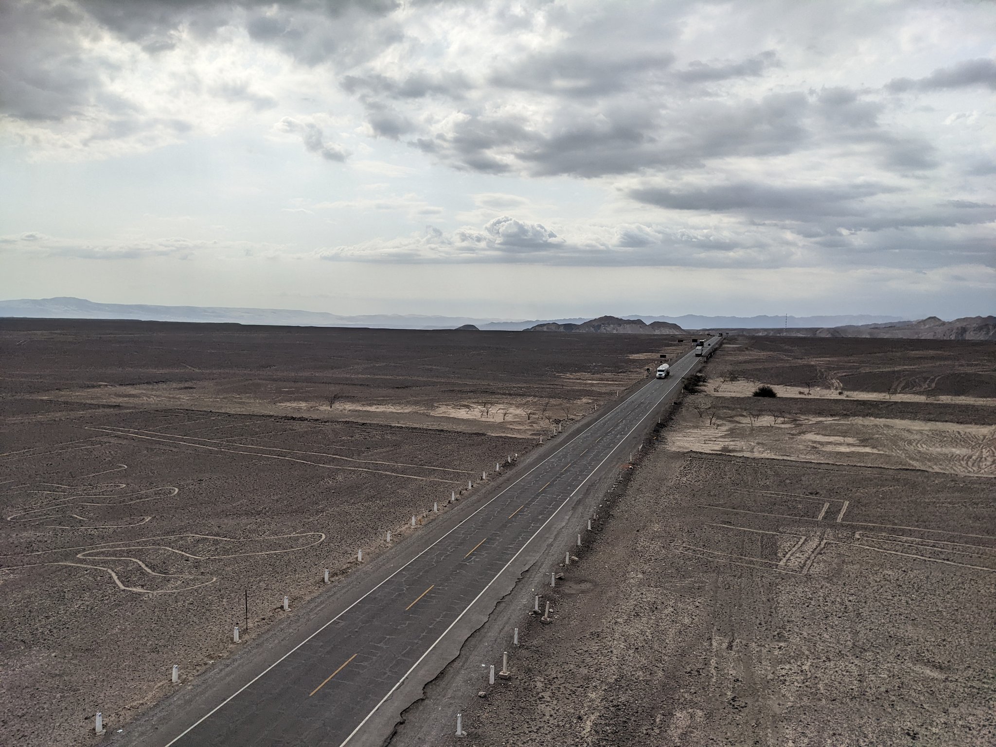
You do not need to fly to appreciate the Nazca Lines, though regulated overflights remain the most comprehensive way to grasp their extent. The Mirador de la Loma and the Mirador de las Pampas offer elevated views of select figures from the Pan-American Highway; tours typically combine these with a small museum visit in Nazca town. If you book a flight, choose a reputable operator that adheres to safety protocols and caps passenger counts for visibility; bring motion-sickness precautions—the tight banking turns are essential for sightseeing. On the ground, never step onto the pampas; even a single footprint or tire track can persist for years. Wear sun protection, carry water and expect extreme dryness. To deepen context, pair Nazca with nearby Cahuachi—an adobe ceremonial center associated with Nazca religion—and with regional museums holding textiles and ceramics that echo geoglyph motifs. Keep in mind that recent research points away from fringe theories and toward a sophisticated desert society whose artworks, paths and water systems were expressions of reciprocity with a harsh environment. The wonder of the Nazca Lines is not only the drawings but the resilient knowledge system that produced them, inviting today’s travelers to observe carefully, tread lightly and let the desert speak.